Discover more from Temple Tales
Note: A map that includes Sinagua ruins and other ancient native and mission sites in Arizona can be seen on my page, the Temple Guy.
Had I known at 18 what I knew at 33, I might have been an archaeologist, and a major focus of that interest is likely to have been the relics of the Sinagua people around Flagstaff, Arizona, some of whose ruins we'll visit in this episode of
TEMPLE TALES!

The Casa Grande near Phoenix. The protective shelter was designed in 1932 by Frederick Law Olmsted, Jr., son and namesake of the man who designed New York's Central Park.
At around 14, I had started shooting a little Argus C3 camera and developing my own black and white film. A year later my family and I stopped on the way home from visiting Mom's cousins in Tucson to soak in the first major Native American ruin I ever recall seeing: the Casa Grande in Coolidge, Arizona, 45 miles or so southeast of Phoenix.
The "Big House" for which the surrounding national monument is named was abandoned sometime around 1450, over three centuries before the Spanish Franciscans built the oldest building I had theretofore seen--the Serra Chapel at Mission San Juan Capistrano. Pioneering Jesuit missionary Padre Eusebio Kino was the first European to see the Casa Grande--in late 1694 already abandoned for over two centuries--and it was he who gave it its rather obvious name. My appetite was further whetted by the fact that this amazing building--said in a park brochure to be "one of the largest prehistoric structures ever built in North America"--was built by a historically unknown people (called "ancient Sonoran Desert people" and usually known as the Hohokam) for an unknown purpose. Kewl!
But in that pre-internet, library-and-encyclopedia-only world, I wasn't able to pursue the experience very far--though I did buy Carlos Castaneda's The Teachings of Don Juan on that trip, which had just been out a year or two. But archaeology--or any other kind of -ology, except maybe mythology--it was not.
It really wasn't until I was a married man (the first time) and a school principal that I revisited some of the same ground, and ultimately got up to northern Arizona and the ruins associated with a people called the Sinagua.
The Sinagua and other Ancient Southwestern cultures
I won't attempt to tell you everything there is to know--or even everything I know--about the Sinagua. Rather, mostly I'll just take you to a handful of sites and share my experiences there. But it won't hurt to give you a wee bit of background on the area.
The Archaic period started perhaps 8,000 years ago, and peoples then present in the modern Southwest made the transition from semi-nomadic and strictly hunting-and-gathering to settled agricultural communities. Thereafter, three large culture complexes emerged.

(Wikipedia)
The name Anasazi has become fairly well known (thanks largely, I think, to the New Age movement!). But the word has fallen into disrepute, and for good reason. It was borrowed from the Navajo people, who in fact were late arrivals in what is now considered the Navajo "ancestral" land, having come around 1400, just a century or so ahead of the Spanish entrada. Being invaders themselves, the Navajos referred to the people whose homeland they had invaded as their "ancient enemies"--the meaning of Anasazi, and the reason that these people's descendants, today's Pueblo peoples, prefer that they be called "Ancestral Puebloans." The ancients occupied a large area around what is now called the "Four Corners" region, where Utah, Colorado, New Mexico, and Arizona meet. (See the map above.)
These people's so-called Basketmaker II Period lasted from around 1500 BCE to 400 CE; the culture we think of when we hear "Anasazi" today, with their distinctive pottery and architecture, emerged around 750 CE. At the other end of their run, most of their signature large cliff dwellings and multi-storied pueblos had been abandoned by 1350, when they migrated south and merged with Puebloan peoples there.
But these "Anasazi" are only one segment of a much larger Pueblo ancestry. Four other, somewhat less understood (and therefore "shadowy") peoples inhabited the area over time: two major and two minor.
The earliest of the major ones (flourishing roughly 200 to 1500 CE) was the Mogollon, whose area more-or-less straddled the Mexican border in modern Arizona and New Mexico. From the cultures to the south they transmitted into the Southwest such cultural staples as the cultivation of corn, the making of pottery, and the settling of villages (the Spanish word for which is pueblo). The Mogollon were named for a mountain range in their territory, which in turn was named for a Spanish Governor of New Spain. (All of these cultures' names are modern, by the way; we don't know what they called themselves.)
Emerging slightly later (roughly 300 to 1500 CE) to the west of the Mogollon were the Hohokam, whose area reached from above Phoenix on down to around the Mexican border; it was they who built the Casa Grande. Their name means "those who have vanished" in the language of the Pima and Papago Indians, who are their descendants and occupy some of their former range.
Both of these cultures overlapped in time with the "Anasazi," whose territory lay to the north of both.
Squeezed into these more widespread cultures, and emerging and borrowing from them, were two later ones: the Salado of the Tonto Basin in southeastern Arizona (named for their home on the Salt River, and thriving from roughly 1150 to 1500 CE); and the Sinagua up around Flagstaff in the north-central part of the state.
We'll discuss the Salado another time. Let's get to the Sinagua.
Sunset Crater: Disaster or No?

The reddish tinge at the crest of Sunset Crater can be seen even through the snow.
The name Sinagua, meaning "without water," comes from an early theory of their emergence, which is now being re-evaluated.
The area they occupy is relatively dry, and the eruption of Sunset Crater in 1064 (or perhaps, as recently revised, 1085) didn't help matters any--or did it? The unnamed people who had been living in the area of its ash-fall--over 800 square miles--had to "head for the hills," as they say.
The volcano's creation seems to have been like that of Paricutin, the cinder cone that sprang up from a vent in a farmer's field in 1943: one day, there was flat land, and in less than a decade there was a 1,400 foot cone. Sunset is a little shorter--1,120 feet. It was named in 1887 by famed Grand Canyon explorer John Wesley Powell, who noted that the oxidized red and yellow rocks on its rim made it appear that the sun was perpetually casting its last rays on it.
Anyway, according to the theory, the short-term disaster ended up being a long-term boon. The ash provided a sort of retaining layer for moisture in the soil, as well as--eventually--a mulch, which aided in agriculture. Hence, farmers could get by with less rainfall, and the name "Sinagua" was later bestowed. (Another widespread explanation of the name is that in 1939, renowned archaeologist Harold S. Colton coined the name from a Spanish name for the nearby San Francisco Peaks; they were surprised that such large mountains produced no perennial rivers. I never heard that until recently.)
By the time I first visited the crater, visitors were no longer permitted to climb to the rim as a result of the erosion caused. It's a national monument, and this protectionism came about when, in 1928, a Hollywood film company was planning to blow up the side of the thing to cause an avalanche for the filming of Zane Grey's Avalanche. The production was stopped, and two years later the national monument was declared by President Herbert Hoover.
--------
Anyway, the number of major Sinagua sites is quite manageable; the minor sites number in the hundreds or thousands--not because there were so many people, but because when they had depleted an area's resources, including firewood, they would just pick up and move on.
But the major sites were not so easy to walk away from, and it is to a half dozen of these that we will turn our attention in this episode.
Walnut Canyon

'Tweren't no earthquake that brought down the front wall of this dwelling at Walnut Creek, but three little letters: T N T.
Let's start just ten miles outside of Flagstaff--a proximity that did the ruins no good.
The rim of Walnut Canyon sits 350 feet above its creator and lifeline, little Walnut Creek, the waters of which ultimately debouch into the mighty Colorado. There were once dwellers on the rimlands who farmed corn, beans, and squash. But by around the year 1100 families started to move partway down the cliffs into places where the canyon's limestone walls had eroded deeply enough to allow for typical rooms maybe 10 x 20 feet (running lengthwise along the cliffs) and six feet high. The rear walls were sometimes excavated to make the rooms roomier, housing 100 or more people. (These days about a thousand times that number visit every year.)
Today a less-than-a-mile loop trail runs over halfway down the sides and passes 25 of these shelters. The Walnut Creek Sinagua only stuck around another century and a half; as with other Sinagua sites, no one is sure why this one was abandoned.
Now, about that "proximity" problem: On August 1, 1882, a route which became the main line of the Santa Fe Railway (which never actually reached Santa Fe) reached Flagstaff. (This line was originally the Atlantic and Pacific Railroad, which touched both of those oceans but had a huge gap in the middle!)
This gave rise to a surge of sightseers, some of whom headed out of the city by the wagonful for picnics. The Indian ruins were a popular spot, and who knows what you could find there?
So they tossed some picks and shovels into the wagons along with their wicker baskets of food. And since it was mighty dark digging inside those little rooms, why not bring along a few sticks of dynamite to toss inside, blowing out the walls and shedding a little light on the subject?
Such wanton destruction led to the establishment of the Walnut Canyon National Monument in 1915, conferring on these ruins the same status as every other site we'll visit in this episode.
I sure enough walked past walls that were not knee-height, but had gone up to the ceiling before the pioneer daytrippers arrived. Fortunately, some of the more remote sights escaped quite such a precipitous plight.
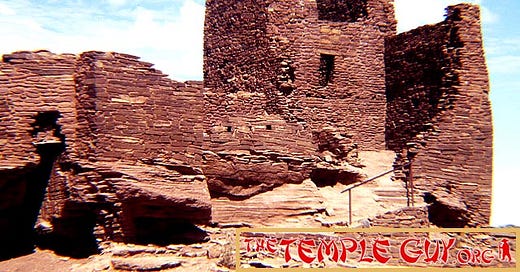
Wupatki, the "Tall House"

Wupatki is a place of many delights.
Wupatki is one of my favorite pueblo ruins ever, especially as it's visited in conjunction with Wukoki (next), both of which are part of Wupatki National Monument and jointly administered with Sunset Crater, which you'll pass on the drive northeast out of Flag toward the easterly portion of the Grand Canyon.
It's pretty common to find larger ruins in some sort of amazing geographic or geologic situation. At first glance, Wupatki (meaning "Tall House" in Hopi, the language of some of these people's descendants) would seem to be an exception: a pretty enough situation, but just sort of sitting in a big more-or-less flat place--until you discover the blowhole.
But first the ruin. It seems that people who had been displaced by Sunset Crater's explosion had been living in scattered housing at higher elevations, but by 1100 or so had started to congregate into larger dwellings, of which Wupatki was the largest in the area. Once home to perhaps 100 people (with up to 2,000 in the "Wupatki Metro area" within a day's walk), it had not the here-and-there nature of Walnut Canyon, but was a solid stone apartment block of over 100 rooms. You'll find nothing larger if you travel 50 miles in any direction.

The reconstructed masonry ball court at Wupatki, furthest-north known example of this Mesoamerican cultural feature
As if that weren't enough to sell units, amenities included a ball court, the furthest-north Mesoamerican-type ball court ever discovered. This reflects the Hohokam influence, and also hints at the extensive trade network of the Sinagua. No one is quite sure exactly how the game was played, though pitch-covered stone balls have been found in various sites, and it may have used elbows and hips, or maybe sticks.
Excavations on the site have turned up some peculiar finds. In one room, seven infants were found buried in stone-lined pits. What could have been the purpose of burying them all together, inside the building? Was it just an unfortunate family?
Furthermore, at least eleven burials of fully-articulated parrot and macaw skeletons were found. Not only were these possibly carried by trade routes from the south, but the burials would indicate that they were clearly prized possessions.

Somebody I used to know demonstrates the effect of the blowhole on one's 'do.
But the most amazing thing about this place, its geologic raison d'etre, is a small blowhole (or more accurately, blowholes; there are several in the area, though only one is showcased near the ruin). The building may have been located here because, in Pueblo belief, the "First Peoples" of the Earth had emerged from the world below through just such a hole (called in Hopi a sipapu, the original of which is supposed to be in the Grand Canyon, literally just up the road from here).
This hole, just a few inches across, is calculated to connect to a network of very narrow underground fissures which, if you were to consolidate them, would amount to seven billion cubic feet--"equivalent," one document says, "to a tunnel 165 feet by 165 feet square and 50 miles long!" (How they settled on this particular description is anyone's guess. Why not "around a 20th of a cubic mile"? Anyway…)
So what? Well, in the daytime, when air pressure on the ground is relatively low (remember how hot air rises?), the pressure under ground is higher, and the hole blows. However, at night, when the outside air is cooler and denser, and its pressure lower, the hole sucks!
Think about it for a minute: between these two phenomena, there must be a balance point, at which the hole is in stasis, neither blowing nor sucking. So on a visit with some dear old friends, we waited at sundown for that very moment, holding small bits of paper over the hole's wire screen until at last they stopped flying upward. And when that moment arrived, my friend--a wise man if ever there was one--wryly observed, "Wow! A hole in the ground that neither blows nor sucks--just like pretty much every other hole in the ground!"
And we moved on.
Wukoki, the "Tower House"

The "tower room" at Wukoki ruin, inside Wupatki National Monument
Not far from the entrance to the Wupatki Visitor Center, and part of the same national monument, is Wukoki (which old-timey archaeologist Harold Colton gives as "Tower House"), one of the most striking of the Sinagua ruins for its sheer simplicity. Like Wupatki, it is built of mortared stone much the same color as the surrounding landscape, but it is much more compact than that edifice, having had only seven or eight rooms on the ground floor, though one section rises three stories looking like an Old-World castle.
Colton calls it "the most picturesque ruin in the Flagstaff area," and I agree. It stands atop a sandstone outcrop rising above the desert, its tower reinforcing the impression that it was built as a defense. However, it was probably simply a home to a few generations of two or three families. Unlike Wupatki, we can enter this ruin, and that simple fact gave me one of my life's peak experiences.
The same evening we watched The Hole That Neither Blew nor Sucked (there must be a Native name for this!), we reached Wukoki in the gloaming and walked up the short path onto its bluff. Making our way over the remains of a ruined wall and through a doorway, we found ourselves in the "Tower Room" as the stars started winking on, and we conceived a plan: To lie quietly facing the sky and, picking out a star, remain until "our" star had traversed from one wall to the other.
I don't remember how long it took, but does it really matter? Time was suspended and for that still moment we shed all care, in repose under the wheeling stars.
--------
Wupatki Monument has other ruins that I have enjoyed visiting: the Citadel up on a lonely mesa; Lomaki House on the rim of a canyon with two dead-ends, the product not of water but of earthquake; and more, but let's go visit the southern Sinagua area, south of Flagstaff.
Tuzigoot (I just love to say it!)

The giant's puzzle that is Tuzigoot
It's true that the "Northern Sinagua" sites are found near or north of Interstate 40, but that's not actually the reason for the distinction (duh). Rather, it's the terrain: driving south from Flagstaff one drops down the Mogollon Rim, the southern edge of the Colorado Plateau in Arizona. While elevations vary wildly, you'd be safe in imagining the land above the rim (to the north) as being 8,000 feet in elevation, and that to the south as 3,000 to 4,000 feet lower.
You can only imagine what that means for climate, ecosystems, and so on. Add to this that much of the Southern Sinagua range is located in what is called today the Verde Valley--Spanish verde meaning "green"--and you start to get the picture. (Sedona, the famed New Age enclave, is located in the north of the Verde Valley.)
In order to see how green is the valley, let's swing west upriver a ways to the little town of Cottonwood and the fun-to-say ruin known as Tuzigoot (say it repeatedly when you feel down!).
The ruin stands on the summit of a ridge overlooking a modern reservoir with an ancient connection. Peck's Lake was built for smelting by a mining operation on a cutoff meander in the Verde River, a feature called "crooked water" or, in the Apache language, "Tuzigoot."
This 110-room complex was excavated by out-of-work miners during the Great Depression. It was long and narrow, built as it was along the outcrop's spine. Though it's built of stone, like the ruins at Wupatki, its appearance differs considerably because of the type of stone: whitish, not reddish, and roundish, not flat. Occupied from 1125 to 1400 CE, it's larger than the other ruins we'll see in the Verde Valley, perhaps simply because of the constricted nature of the next two building sites. And as with many pueblos, the exterior walls exhibit few doors; rooms were entered through rooftops, reached by ladders which could be drawn up at night or in times of trouble.
The most delightful view of Tuzigoot is from the top. Looking downhill at the low-walled open rooms, we see something that looks more like a giant's puzzle than a building.
Montezuma Castle

Imposing Montezuma Castle sits a-way up on the cliff-side.
Now let's head south--downriver--and after a ways swing northeast up Beaver Creek to the inaptly named Montezuma Castle. As someone once said, Grape-Nuts cereal is neither grapes nor nuts; and Montezuma Castle is neither a castle nor built by Montezuma (or his kin).
The oft-told tale is that early Euro-American visitors to the site were so dumb that they though Montezuma had something to do with this imposing structure's origins. More charitably, I think the name reflects just a touch of whimsy.
But it does suit the grandeur of the place. It's five stories tall, but the foundation is up a cliff-side nearly a hundred feet above the viewer's head! Its lofty location (a proof of the builders' skill) may have been defensive--like Tuzigoot access was only via a series of ladders--but just as likely it was to avoid seasonal flooding in usually-tame Beaver Creek. Some floods were a blessing for agriculture, but a threat to architecture!
Additionally, upon that cliff-side is where the builders found the massive alcove which provides protection from precipitation, perhaps another "secret" of the structure's preservation. Its 45 to 60 rooms were built and occupied between approximately 1100 and 1425 CE, using limestone found at the cliff's base and clay mud from the creek bottom.
It truly is magnificent.
Montezuma Well

Note the "homes" just under the rim of Montezuma Well.
Five or six miles northeast from his castle, on the other side of the town of Rimrock, Montezuma also built a well.
Let me just pause here to tell you that, in researching this episode, I stumbled upon something called the "Montezuma Mythology," which my friends at Wikipedia describe as belief in "a heroic-god in the mythology of certain Amerindian tribes of the Southwest United States," this including the Pueblo peoples.
This is not the guy from the halls down in Mexico City, though; he was a local, "conceived from a beautiful virgin and a pinyon pine nut." He could make rain (very important here) and taught the people the use of adobe.
This story is all the more interesting to me because it may have been manufactured for the tourists. Early ethnographer Adolph Bandelier (whom we met in Episode 043) claimed in the 1890s that the Puebloans had made it up 50 years before his time; but more recent documents seem to prove that the Spanish were aware of this Puebloan teaching long before the "invention" alleged by Bandelier. In one report dating to 1694, they told Padre Kino that Montezuma had built the Casa Grande with which we started this episode! Mystery within mystery!
Now, to the well. This is a huge sinkhole, some 386 feet across and in places as much as 124 feet deep.
But you won't see that far, because the thing is filled with water! Two springs at the bottom pump out a million and a half gallons of water every single day, water that originally fell as snow and rain above the Mogollon Rim over 10,000 years ago, whence it trickled down into an aquifer. The ancient springs built up a mound of limestone; hollowed it out over time; and ultimately caused it to collapse, opening the well to the sky.
Never ones to waste a resource, the Sinagua built houses into crevices of the well's walls, and--since the water level is actually above the surrounding ground level--they channeled the water running out of a natural tunnel (called a "swallet"--new word!) in the mound's side to irrigate their fields.
So much water naturally occurring in the desert is something of a miracle. The modern Yavapai people--whose disruptive arrival around 1300 CE may have hastened the departure of the Sinagua from the area--consider the Well to be their sipapu, the place from which their First People emerged from the earth.
Why not?
--------
Well, that's about that. I'm so glad you could join me as I revisited these precious sites.
Until next time, may you and your loved ones and all sentient beings be well and happy.
Adios, Amigos!
QUESTIONS:
Which of these ruins seems most attractive to you? Why?
Many of the "tourist attractions"--Mesa Verde, Chaco Canyon, and so on--are much grander than these. Do you prefer large, showy sights (think "pyramids" or Great Wall"), or more intimate, manageable sites like the ones shown in this episode?
Have you ever been to a Native American ruin? Tell us about it.
Subscribers: Although I have enabled comments for this post here on Substack, there's still a "Secret Group" on Facebook where your questions and comments can get more personal attention. If you're not already a member, let me know and we'll figure out how to loop you in! (Of course, if you don't use Facebook--sorry!) Oh, and Non-subscribers? Join the club!
GET MORE:
Listen to the audio version of this post at Archive.org.
Find the Podcast on iTunes, GooglePlay, or Spotify (find the raw feed here)
You may unsubscribe to Temple Tales at any time by simply replying to this Newsletter and writing "Unsubscribe." You will receive one more letter as confirmation.
If you have any problems reading the Newsletter or accessing the Podcast, please write to me at TheTempleGuy@GMail.com, and I'll help you in any way I can!
In the next episode: Back to Japan for a visit to my "home temple," Tokyo's Senso-ji in Asakusa, and a crazy little heron dance at a festival!